
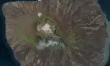
An 8×8 km volcanic island based on Fernandina in the Galápagos: a 575 m shield volcano with a caldera at its summit, and around 100 km of roads, rally stages and trails. Work in progress.
Players now
0
Servers
0
Rating
100%
1 votes
Subscribers
-
51 downloads
Busiest servers running it 0 in total
No server is running this mod right now.
Players on servers with it
daily, last 30 days
Details
- Author
- General Kenobi
- Version
- 1.8.3
- Size
- 238.0 MB
- Licence
- APL
- Game version
- 1.8.0.13
- Likes
- 0 / 0 dislikes
- Published
- 21 Aug 2026
- Updated
- 2 weeks ago
- Workshop ID
- 66E600D5397B1040
Recent adoption
30 days: +1 −2 ↑1
- − Jägers PVE 1.8.3 2d ago
- + Jägers PVE 1.8.3 3d ago
- − [NA2] SHOOTHOUSE Zombies Playtest | discord.gg/wW8qZqHzsD 1.8.3 1w ago
- ↑ [NA2] SHOOTHOUSE Zombies Playtest | discord.gg/wW8qZqHzsD 1.8.2 1.8.3 2w ago
Version history
3-
v1.8.3 238.0 MB 30 Sep 2026
Terrain - Re-imported the heightmap with a 575 m summit and a cleaner coastline. - New greener satellite texture and updated surface masks. Road network (~100 km) - Asphalt network (53 km): a coastal ring road around the island, 8 m wide, narrowing to 6 m through settlements. Also the Carretera de la Cumbre, del Sur and del Poniente climbs to the summit, three mid-slope connector roads, the HQ–Punta Espinoza pier road, and SS1 Anillo del Cráter around the crater rim. - Dirt roads (12 km): caldera access roads (Subida Sur, Bajada Poniente), mid-slope links, and spurs to the Planta Pesquera, the Depósito de Combustible Norte and the Almacén de Contrabando. - Rally stages (17 km): SS2 Travesía Oriental, SS3 Caldera Interior, SS5 Lava Negra, SS6 Cantera, SS7 Norte Bajo, SS8 Descenso Norte and SS10 Contrabando. - Walking trails (20 km): 9 trails, including Punta Espinoza, Mangle–Cumbre, the Fisuras, Cabo Douglas, Flujo Reciente, Norte and Cabo Hammond. - Roads are graded into the terrain with capped gradients. Junctions are matched in height so connecting roads meet cleanly. - Fixed roads folding back on themselves at their start point, which caused "invalid segments" errors and visible kinks at junctions. Vehicles - S105 rally cars at the HQ and at the stage starts, plus a civilian UAZ near the summit. Game Master scenario - The GM world now builds on the populated world, so it includes all roads, trails and vehicles. - In-game map: satellite background image, road network and map geometry (areas and buildings). - Removed a duplicate map entity. AI - Regenerated the soldier and vehicle navmeshes for the new terrain and roads.
-
v1.8.2 159.1 MB 21 Aug 2026
-
v1.8.1 159.1 MB 21 Aug 2026
Description from the Workshop
ISLA FERNANDINA Galápagos, 1989: La Crisis de la Cumbre Fernandina is the youngest and most active volcano in the Galápagos. It's a shield of black lava rising straight out of the Pacific, with a 1.5 km wide caldera at its summit. This map recreates the real island at 8×8 km, built from real elevation and satellite data. The setting In 1984 the islands' breakaway military junta leased the summit to the Soviet Union, officially "for volcanological research". Soviet engineers arrived with bulldozers and asphalt plants, and to keep the islanders happy they started a rally championship. Five years later the volcano is covered in rally roads, and a US reconnaissance photo shows something in the crater that doesn't look like science. American Marines land in the north-east and Soviet naval infantry in the south-east. The mountain in between is up for grabs. Features - Volcanic terrain: a 575 m summit, a 1.5 km wide caldera, lava fields, green upper slopes and a rugged coastline with small coves. - Asphalt network (~53 km): a ring road around the island, three climbs to the summit, mid-slope connector roads and a loop around the crater rim. - Rally stages (~17 km): seven gravel stages running down every flank of the volcano, from the crater floor to the coast. Rally cars are waiting at the stage starts. - Dirt roads (~12 km): caldera access ramps, mid-slope tracks and spurs to the fish plant, the fuel depot and a smugglers' warehouse. - Walking trails (~20 km): nine foot paths across lava flows, fissures and headlands for infantry. - In-game map: satellite background image with the full road network. - Game Master scenario: 64 players, with AI navigation for soldiers and vehicles across the whole island. Status Work in progress. The terrain, road network and Game Master scenario are playable now. Settlements, bases and a Conflict mode are planned for later updates.